Flooding or inundation occurs when stream sources overflow after a heavy rain or when sudden precipitation accumulates in topographic pits. Financial and emotional damage negative effects of this natural event can be prevented by various analyzes.
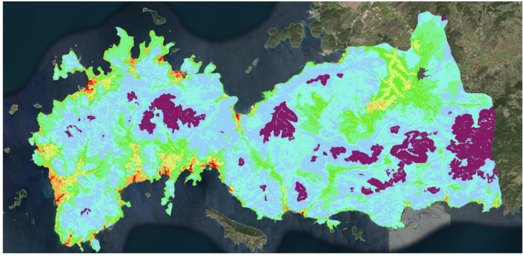
In this context, as the UrClimate team, district-based flood risk maps were prepared using spatial data. The characteristic topography of each district was examined with various spatial data sets, and the risk scoring of areas where flooding could occur was presented.
With this study;
- To create a foresight of the environment that may be flooded,
- Enabling the investor to apply for a policy by taking the most appropriate measures by using the database provided by insurance companies,
- To support the decision-making mechanisms of public institutions and organizations with flood forecasting,
- It was aimed to decide or support the process of choosing the most suitable location for investment.
As the UrClimate team, a high-consistency and up to 25m resolution flood risk score was visualized and map-based service was provided.
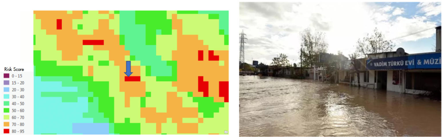
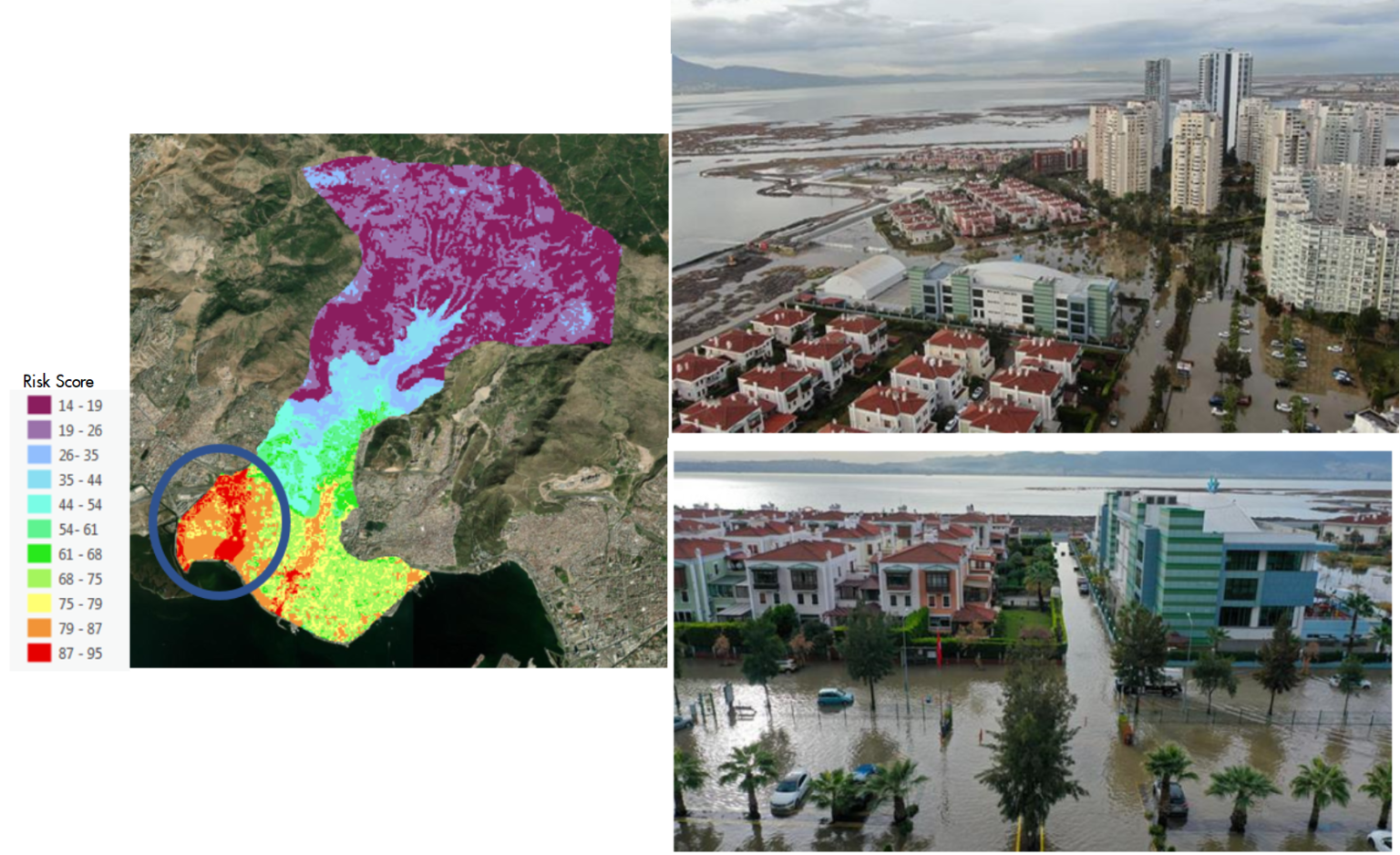
The Flood risk map was compared with the natural disaster locations that occurred in the past. Considering the flood that took place in Beşiktaş district of Istanbul province and its location indicated by the blue arrow on the map presented, the location is located in a high-risk area.
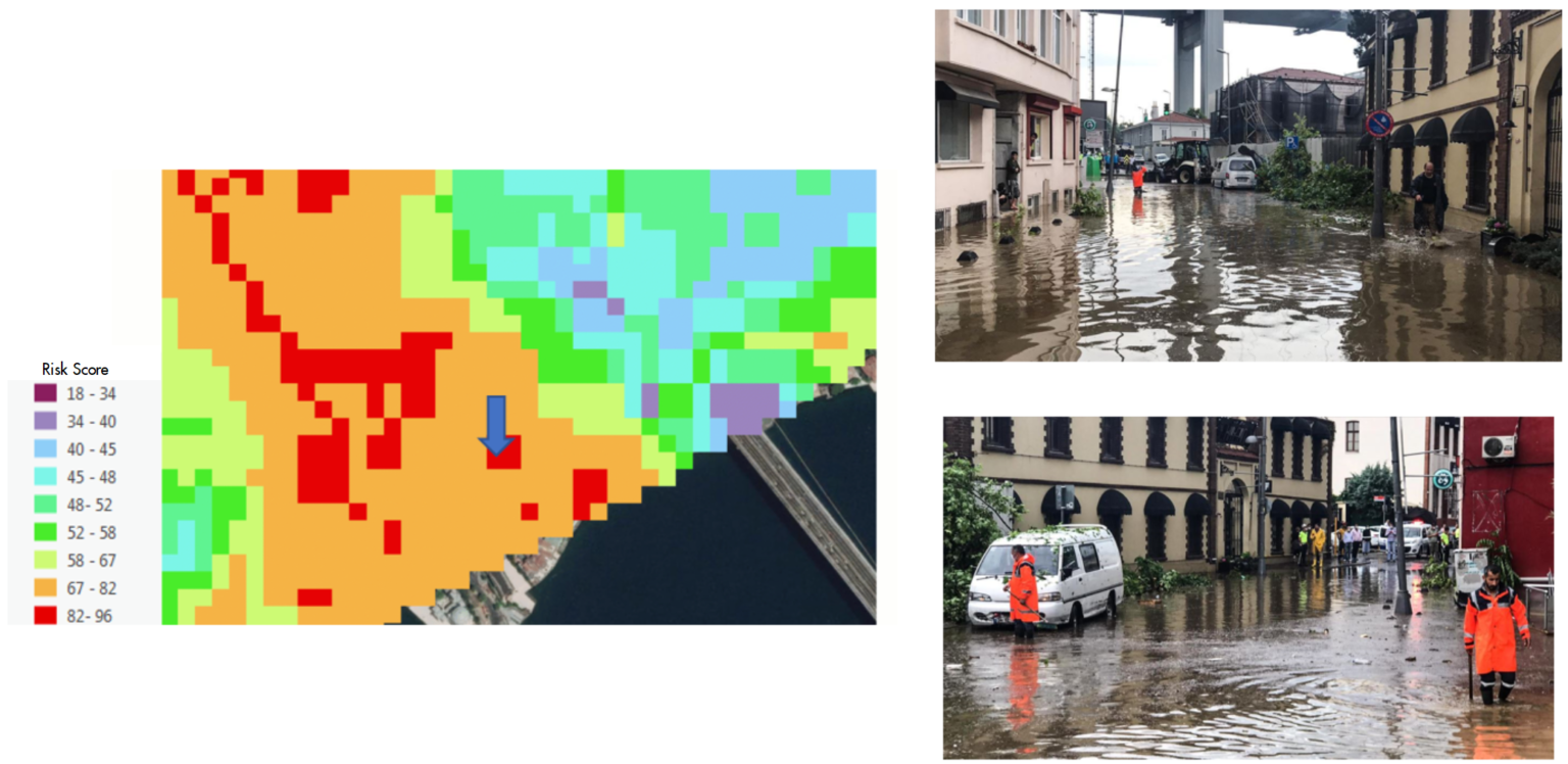
Thanks to the high resolution of the presented map, detailed analyzes were carried out. Side-use areas of rivers do not pose a high risk at all times and places. The rivers overflow towards the pit region topographically. Analyzes were made to identify these regions and perform the scoring process. An example of this situation is the Kemer district of Antalya Province. The relevant stream overflow was identified as seen in the risk map.