Famous Turkish poet Cenap Şahabettin used to say: “The one who does not prepare a lamp during the day is satisfied with the darkness of the night.”
Climate change brings with it various disasters. Disasters cause loss of life and property. In order to minimize these losses, studies should be carried out on various activities. As the UrClimate team, we have worked on the flood disaster caused by sudden heavy rains brought about by climate change. As a result of the analyzes made within the framework of the algorithms we have developed, we can calculate the location-based topographic flood risk score with a resolution of 25 meters. We store risk scores in a spatial database and present them with map-based visualization. With this study, predictions can be made about areas that may flood. The spatial database is used by insurance companies and enables the investor to apply for a policy by taking the most appropriate measures. Analyzes can support the decision-making mechanisms of public institutions and organizations with flood forecasting.
The flood risk scores produced by the developed algorithm are visualized on a map basis. The consistency of the comparison of the flood and risk database we produced in the residential area of York, England, which is one of the most important locations regarding flooding, is supported by visuals.
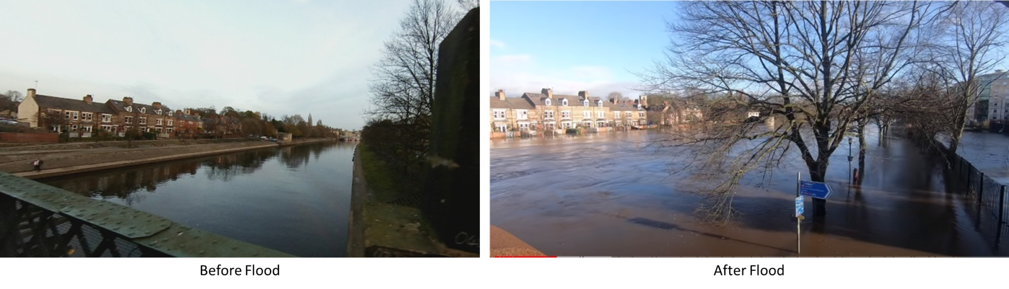
Scarborough Bridge
Images from Scarborough Bridge before and after flooding show just how much area flooding can affect. These areas are located in a high risk area.

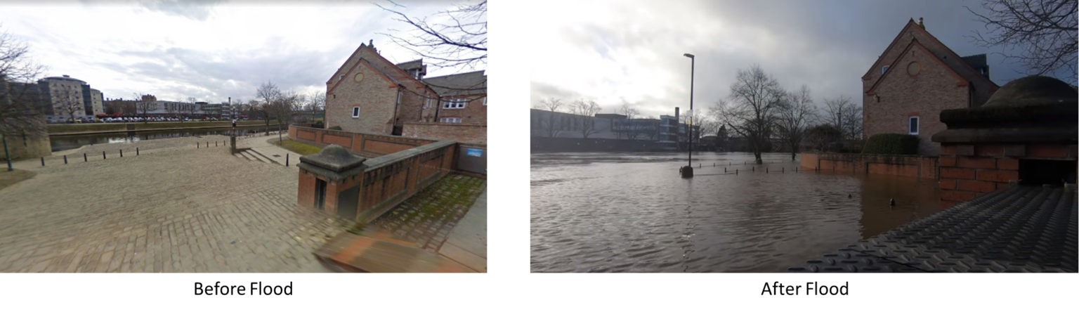
Marygate
At the Marygate location, it can be seen how high the flood waters have risen. The area where the flood waters rise and the end point of the red high-risk area on the map produced are the same. The relevant location is located in the high-risk area in our database.

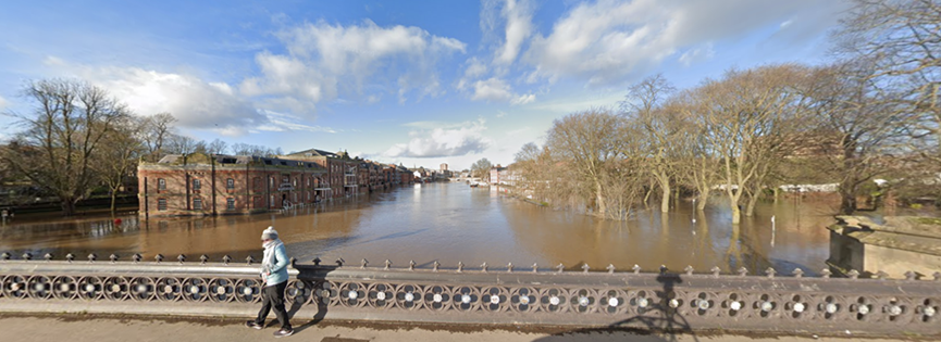
Skeldergate Bridge
When viewed from the Skeldergate Bridge, it is understood that various residential areas and green areas have been damaged. It is possible to see same how the flood progressed in the location and map presented in the database we produced. Areas where flood waters expand are defined as high risk in our database.