Risk maps which based on meteorological data are identified as a need in Turkey, are supplied by Alkazar as a ready to use product for the aviation, defense, insurance, energy, agriculture and building sectors. Meteorological risk data, which each sector can use to make different interpretations within itself, enable a more detailed examination of the area to be invested. For the insurance industry working with all other sectors, these data are offering an advantage in understanding, protecting, and directing customer risks.
Accurate and high-resolution long-term history of meteorological analysis are so much needed in the world, especially in Turkey. The spatial resolution of the platforms in which weather forecast companies or reinsurance teams are developed on a global scale, cannot meet the requested detail or consistency for the local.
As emphasized in chaos theory, the atmosphere itself is a complex and chaotic phenomenon. Therefore, there is no fully validated analytical methodology for evaluating weather events, regardless of the quality of the input data. Hence, it is tried to converge to the best result by developing new algorithms and performing numerical calculations with high performance.
Computers and numerical solvers are used together to numerically describe the behavior of the atmosphere and analyze non-linear equations that cannot be solved analytically. Numerical weather forecast models using low spatial resolution meteorological observation data and solves the linear equations formed by discretizing the continuous equation system to obtain time series outputs. The amount of resources used in the numerical solution of differential equations depends on both temporal and spatial resolution. Thanks to cloud computing services, high resolution speeds can be achieved, and hundreds of terabytes of output can be stored.
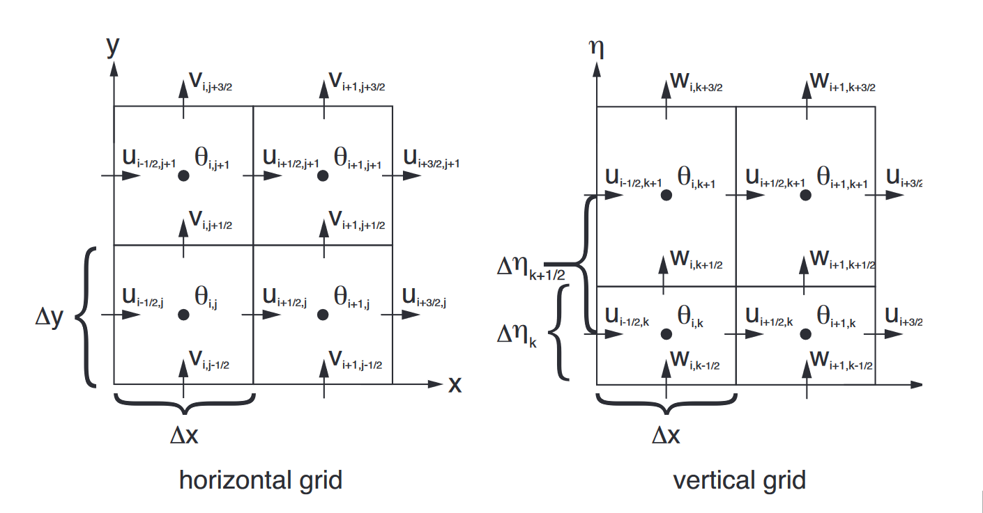
Alkazar has the infrastructure of the ability to develop numerical analysis algorithms for atmospheric dynamics and atmospheric thermodynamics to reach accurate results in Amazon Web Services (AWS) and Google Cloud high-performance cloud computing resources. Thanks to its investment infrastructure of hundreds of thousands of dollars, Alkazar Climate Risk Data Set (AİRVS) was produced by engineers experienced in meteorology under the supervision of academic consultants. Long-term meteorological outputs for Turkey in 3 km horizontal resolution were created by using together with physical solution algorithms which were developed in-house by Alkazar, and the state-of-the-art mesoscale atmospheric numerical models. In the calculations, a total of 6200 processor cores were parallel run for 720 hours. Statistical and machine learning methods are blended with big data technologies to process outputs of approximately 200 terabytes. Depending on the distribution of intensity and frequency, the L-type risk matrix is used to interpret each data. Risk maps are available to those who need it via application programming interface (API) or visual user interface (GUI) (UrClimate Score).
Data types which are included and will be added (*) in the AİRVS
- Lightning Risk
- Snow Depth Risk
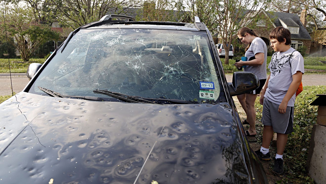
- Hail Risk
- Storm Occurrence Risk
- Rain Risk
- Low Visibility Risk
- Agricultural Frost Risk
- Snow Load Risk *
- Avalanche Risk *
- Fog Risk *
- Frost Risk *
- Air Pollution Risk *
- Forest Fire Risk *
After many research on lightning, long-term lightning risk analysis on Turkey was created by Alkazar and later, was presented at EGU2020 which was driven by European Geosciences Union (EGU) (Yılmaz, 2020).
It is progressing with innovative studies produced by meteorological, fluid mechanics and software engineers who work within Alkazar, specialized in their fields. Also, it has the Office Registration Certificate issued by the Chamber of Meteorology Engineers and continues all these processes by examining with academic advisors from Norway Bergen University, Newcastle University, and Istanbul Technical University.
Reference